Wildfire Restrictions, Defensible Space & Webinars
The current fire level is set to HIGH
STAGE 1 FIRE RESTRICTIONS START FRIDAY, AUGUST 29, 2025
What does the fire danger mean?
The Fire District does not allow control (slash) burning from Memorial Day through Labor Day or when the fire danger is HIGH, VERY HIGH, or EXTREME. A permit is required to have a control burn and can be applied for through our Community Connect platform.
Recreational (camp) fires are allowed within the District. A permit is required to have a recreational fire on private property throughout all areas of Summit County and can be applied for through our Community Connect platform.
We recommend you refrain from having a recreational fire when the fire danger is HIGH, VERY HIGH, or EXTREME or when there is a Red Flag or Fire Weather advisory.
Fire Danger Level: Low
When the fire danger is "low," it means that fuels do not ignite readily from small embers, but a more intense heat source, such as lightning, may start fires in duff or dry rotten wood. Fires in open, dry grasslands may burn quickly a few hours after a rain, but most wood fires will spread slowly, creeping or smoldering. As a result, control of fires is generally easy.
Fire Danger Level: Moderate
When the fire danger is "moderate," it means that fires can start from most accidental causes, but the number of fires that start is usually pretty low. If a fire does start in an open, dry grassland, it will burn and spread quickly on windy days. Most wood fires will spread slowly to moderately. Average fire intensity will be moderate except in heavy concentrations of fuel, which may burn hot. Fires are still not likely to become severe and are often easy to control.
Fire Danger Level: High
When the fire danger is "high," fires can start quickly from most causes, and small fuels (such as grasses and needles) will ignite readily. Unattended campfires and brush fires are likely to escape. Fires will spread quickly, with some areas of high-intensity burning on slopes or concentrated fuels. Fires can become severe and difficult to control unless extinguished while they are still small.
Fire Danger Level: Very High
When the fire danger is "very high," fires will start quickly from most causes. The fires will spread rapidly and quickly increase in intensity right after ignition. Small fires can quickly become large and exhibit extreme fire intensity, such as long-distance spotting and fire whirls. These fires can be challenging to control and will often become much more extensive and longer-lasting fires.
Fire Danger Level: Extreme
When the fire danger is "extreme," fires of all types start quickly and burn intensely. All fires are potentially serious and can spread very quickly with intense burning. Small fires become big fires much faster than at the "very high" level. Spot fires are probable, with long-distance spotting likely. These fires are challenging to fight, may become very dangerous, and often last several days.
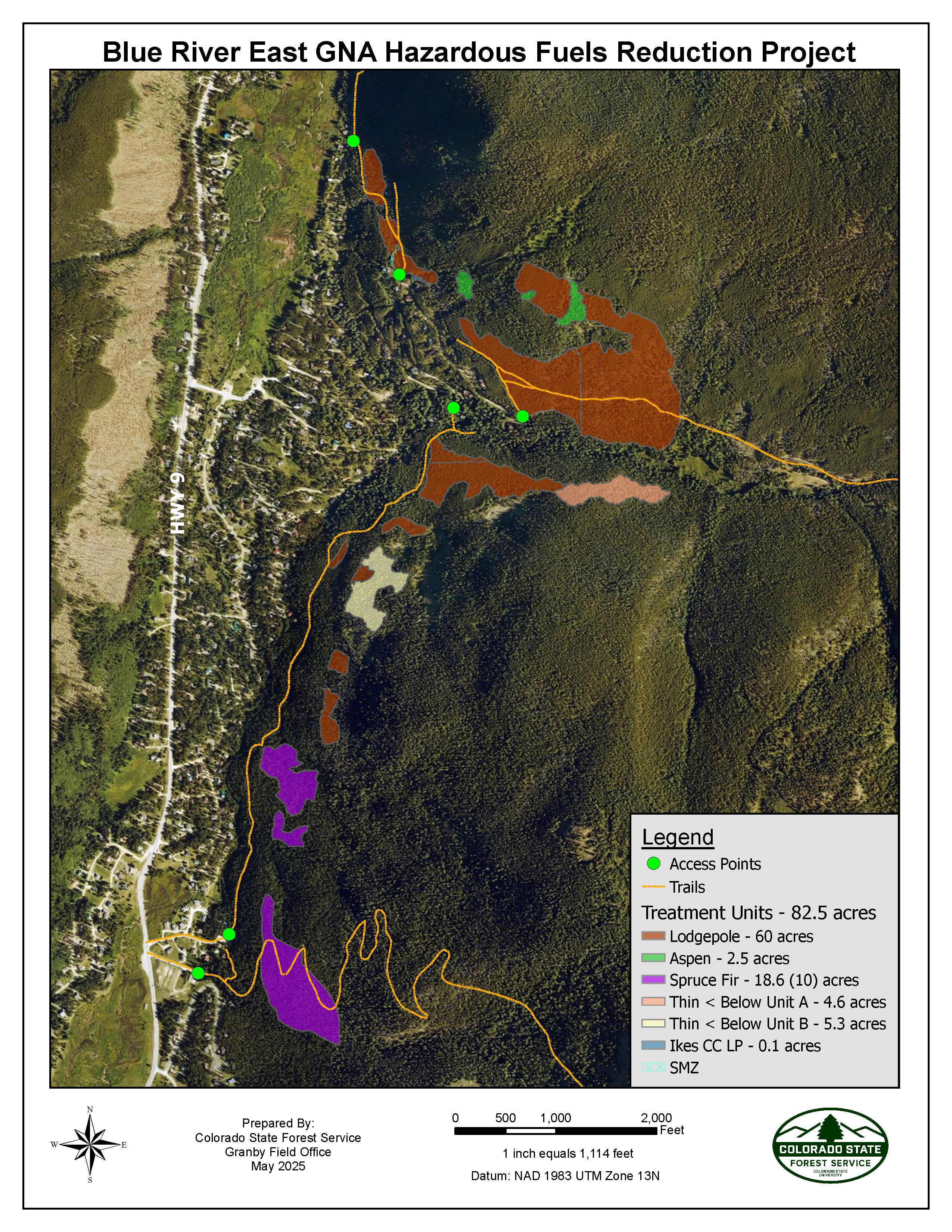
Blue River East Good Neighbor Authority Hazardous Fuels Reduction and Forest Health Project
Blue River East Good Neighbor Authority Hazardous Fuels Reduction and Forest Health Project
Overview:
The Blue River East Hazardous Fuels Reduction and Forest Health Project is an 83-acre fuel break located near the Town of Blue River on the east side of Highway 9. The project is taking place on U.S. Forest Service (USFS), Summit County, Town of Breckenridge, Town of Blue River, and private lands. These lands are identified as high priority areas in Summit County’s Community Wildfire Protection Plan and USFS’ Breckenridge Environmental Assessment. The project is a part of the Good Neighbor Authority (GNA) program and is administered by the Colorado State Forest Service (CSFS).
Hand crews started working June 2025 and will only work during the summer months (June-September). The project will be completed by October 2026 or sooner.
Project Goals:
The goals of the fuels reduction and forest health project are to reduce the volume and connectivity of fuels within the project area, increase the watershed’s resilience, regenerate an old, unhealthy forest, and introduce age class diversity back into the landscape. Strategically connecting, strengthening and building upon the series of existing fuel breaks around the Blue River area directly reduces wildfire hazards to the surrounding community and allows firefighters a greater opportunity to engage safely in fire suppression activities in the event of a wildland fire. Science-based treatments like this also create favorable forest conditions for wildlife habitat along with creating resilience to large scale disturbances such as pine and spruce beetle outbreaks.
Current Forest Conditions:
The current forest conditions are comprised of an old, stagnated lodgepole pine forest to the north and an overgrown, dense spruce fir forest to the south. These dense, old forests are at the end of their successional stage and are susceptible to insect and disease outbreaks and catastrophic wildfire. The treatments aim to create a strategic fuel break and regenerate a healthy forest for present and future generations and all that rely on its resources.
Treatment Design and Prescription:
The cutting of live and dead trees is a scientifically based and ecologically conscious way to mimic the historic cycle of stand-replacing fires that inter-mountain western forests are adapted to, but without the undesirable consequences of home loss, drinking water degradation, and habitat loss.
Within the even-aged, shade-intolerant lodgepole pine ecosystems, all dead trees and live lodgepole pine in the overstory will be removed. Smaller, live lodgepole pine trees that are healthy will be retained, as well as spruce, fir, and aspen trees.
In the multi-aged, shade-tolerant spruce and fir forest type, group selection, or openings, ½ - 2 acres in size will create favorable conditions for the establishment of a new age class. In these gaps, all medium sized live and dead Engelmann spruce, subalpine fir, and lodgepole pine trees will be removed.
Treatment Method:
Hand crews with chainsaws will implement the treatments. Due to poor access and extremely steep topography, the woody material cannot be hauled off site. The hand piles will be burned by the USFS and local fire protection districts in the winters following project completion when there is adequate snow coverage. No treatment will take place on slopes greater than 30% to mitigate the risk of avalanches and mud slides.
Impacts to Residents and Recreation:
All operations (cutting, piling, etc.) are restricted to 7:00 a.m. – 7:00 p.m. Monday through Saturday within 500 feet of houses. The Wakefield/Blue River trail & Pennsylvania Creek Road are within treatment units and will remain open; however, they will be closed for up to 30 minutes or less at a time whenever work is being conducted near the trails. Signs will be displayed, and flaggers will be controlling recreation traffic during these temporary closures. Do not approach sawyers or workers, as operations and falling trees can cause serious injury or death.
Project Collaboration:
Partners on the project include the Colorado State Forest Service, the U.S. Forest Service, Summit County Open Space, Town of Breckenridge, Town of Blue River, Red White & Blue Fire Protection District, and private landowners.
Funding for this project has been granted through the Summit County Strong Future Fund, The Nature Conservancy, and the USFS.
Contact:
This project is managed by the Colorado State Forest Service. Please contact Project Administrator Francisco Murphy-Garcia with any questions at francisco.murphy-garcia@colostate.edu.
Defensible Space Program
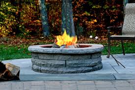
Fire Pit Permits
Summit County Slash Program
Fire Mitigation Tips
Courtesy Red, White &, Blue Fire District. www.rwbfire.org
https://www.youtube.com/watch?v=vL_syp1ZScM
https://www.youtube.com/watch?v=pfbEcMeYFFA
Tips to Protect Your Home From Wildfire
- Actively manage your roof. Clean roof and gutters of pine needles and leaves at least twice a year to eliminate an ignition source for potential fires. This eliminates an ignition source for firebrands, especially during hot, dry weather.
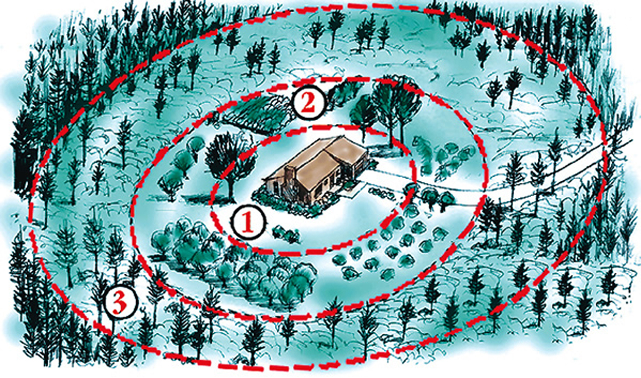
- Beyond the initial 15 feet, thin trees to achieve 10-12 foot crown spacing. Occasionally, clumps of 2 or 3 trees are acceptable for a more natural appearance, if additional space surrounds them.
- Create defensible space on flat ground a minimum of 75 feet around a home. Increase this diameter if the structure is located on a slope.
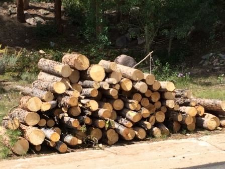
- Dispose of all slash and debris left from thinning by either chipping, hauling away or piling and burning. Contact your local fire department or local Colorado State Forest Service forester for burning restrictions and/or assistance.
- Mow grasses and weeds to a height of 6 inches or less for a distance of 30 feet from all structures.
- Place liquefied petroleum gas (LPG) containers at least 30 feet from structures. Clear anything flammable, including vegetation, from within 10 feet of all tanks.
- Prune tree branches within the defensible space up to a height of 10 feet above ground.
- Remove shrubs and small trees or other potential ladder fuels from beneath large trees. Left in place, these fuels can carry a ground fire into tree crowns.
- Remove unhealthy vegetation. Trees and shrubs that are stressed, diseased, dead or dying should be removed so that they do not become a fuel source for potential fires.
- Stack firewood away from your house. Locate firewood at least 15 feet uphill from your home. Do not stack firewood under the deck.
- Thin out continuous tree and brush (shrub) cover around structures. Remove flammable vegetation from within the initial 15 feet around structures.
- Trim any branches extending over roofs, and remove branches within 15 feet of chimneys.
Ready, Set, Go
The Ready, Set, Go! (RSG) Program seeks to empower fire departments to engage the residents they serve in wildland fire community risk reduction. The RSG! Program provides free tools and resources for fire departments to use as they help residents gain an understanding of their wildland fire risk and actions individuals can take to reduce that risk. Engaging in this dialogue is particularly important for the fire service as national studies have shown that firefighters are uniquely respected in their communities and can project a trusted voice to the public preparedness appeal. They can also explain what fire resources are available during an event and the role that individuals should play in preparedness and early evacuation – if called for by their local officials – to increase the safety of residents and first responders.
The RSG! Program works in complementary and collaborative fashion with FirewiseUSA® and other existing wildland fire education efforts. It amplifies the preparedness messages to better achieve the common goal we all share of fire adapted communities. When firefighters encourage residents to take personal responsibility for preparing their property and family for wildland fire, residents become an active part of the solution. The more residents actively involved in mitigating their properties and preparing for evacuation, the greater a community’s resiliency to wildland fire.
The RSG! Program is managed by the International Association of Fire Chiefs (IAFC). Launched nationally in March 2011 at the Wildland-Urban Interface (WUI 2011) Conference, the program helps fire departments teach individuals who live in high-risk wildland fire areas how to best prepare themselves and their properties to adapt to living with fire.
How Can I help?
Find out more information on what you can do to be ready and assist the Town of Blue River towards a goal of being a Firewise Community.
https://www.wildlandfirersg.org/s/?language=en_US
https://www.nfpa.org/Public-Education/Fire-causes-and-risks/Wildfire/Firewise-USA